Difference between revisions of "Nam Et-Phou Louey National Park"
| (6 intermediate revisions by 3 users not shown) | |||
| Line 1: | Line 1: | ||
| − | |||
| − | |||
| − | |||
| − | |||
| − | |||
| − | |||
| − | |||
| − | |||
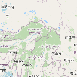
[[Asia]] > [[Laos]] > [[Nam Et-Phou Louey National Park]] | [[Asia]] > [[Laos]] > [[Nam Et-Phou Louey National Park]] | ||
| − | {{#display_map: height= | + | |
| − | |20.517794, 103.592093~[[Nam Et-Phou Louey National Park]]~ | + | '''[https://wiki-iucnapesportal-org.translate.goog/index.php/Nam_Et-Phou_Louey_National_Park?_x_tr_sl=auto&_x_tr_tl=fr&_x_tr_hl=en&_x_tr_pto=wapp Français]''' | '''[https://wiki-iucnapesportal-org.translate.goog/index.php/Nam_Et-Phou_Louey_National_Park?_x_tr_sl=auto&_x_tr_tl=pt&_x_tr_hl=en&_x_tr_pto=wapp Português]''' | '''[https://wiki-iucnapesportal-org.translate.goog/index.php/Nam_Et-Phou_Louey_National_Park?_x_tr_sl=auto&_x_tr_tl=es&_x_tr_hl=en&_x_tr_pto=wapp Español]''' | '''[https://wiki-iucnapesportal-org.translate.goog/index.php/Nam_Et-Phou_Louey_National_Park?_x_tr_sl=auto&_x_tr_tl=id&_x_tr_hl=en&_x_tr_pto=wapp Bahasa Indonesia]''' | '''[https://wiki-iucnapesportal-org.translate.goog/index.php/Nam_Et-Phou_Louey_National_Park?_x_tr_sl=auto&_x_tr_tl=ms&_x_tr_hl=en&_x_tr_pto=wapp Melayu]''' |
| − | }} | + | |
| − | + | __TOC__ | |
| + | = Summary = | ||
| + | |||
| + | <div style="float: right">{{#display_map: height=190px | width=300px | scrollzoom=off | zoom=5 | layers= OpenStreetMap, OpenTopoMap|20.517794, 103.592093~[[Nam Et-Phou Louey National Park]]~'Nomascus leucogenys''}}</div> | ||
* Northern white-cheeked crested gibbons (''Nomascus leucogenys'') are present in Nam Et-Phou Louey National Park. | * Northern white-cheeked crested gibbons (''Nomascus leucogenys'') are present in Nam Et-Phou Louey National Park. | ||
* The population size is unknown. | * The population size is unknown. | ||
| Line 19: | Line 14: | ||
* Conservation activities have focused on community engagement, improved land use practices and livelihood development, and anti-poaching interventions. | * Conservation activities have focused on community engagement, improved land use practices and livelihood development, and anti-poaching interventions. | ||
| − | = Site characteristics = | + | |
| − | + | ||
| − | + | = Site characteristics = | |
| − | + | ||
| − | |||
| − | |||
Nam Et-Phou Louey National Park (previously two individual National Protected Areas: Nam Et and Phou Louey) is located in the north-east of Lao PDR (Laos) and is the second largest protected area in the country (over 500 square kilometers). Spanning ten districts across three provinces (Houaphan, Luang Prabang and Xieng Khouang), the protected area is marked by steep mountainous topography, with elevation ranging from 336 to 2257 m. Nam Et-Phou Louey is remarkable for its rich wildlife biodiversity with a wide range of species, many endangered, including clouded leopards (''Neofelis nebulosa''), dholes (''Cuon alpinus''), northern white-cheeked gibbons (''Nomascus leucogenys''), Phayre's langur (''Trachypithecus phayrei''), sun bears (''Helarctos malayanus''), Asiatic black bears (''Ursus thibetanus''), Sunda pangolins (''Manis javanica''), Chinese pangolins (''Manis pentadactyla''), big-headed turtles (''Platysternon megacephalum''), impressed tortoise (''Manouria impressa''), oriental small-clawed otter (''Aonyx cinereus''), Burmese python (''Python bivittatus''), mainland serow (''Capricornis sumatraensis''), sambar deer (''Rusa unicolor''), Asian elephants (''Elephas maximus''), and Owston’s palm civet (''Chrotogale owstoni''). There are currently over 50 species of large mammal; of these there are over 20 species of carnivore (including 4 species of cats, 8 species of civet, 3 species of otter, and 2 species of bear), 8 species of primates, and 5 species of ungulate. There are 36 species of bats, over 20 species of reptiles and amphibians, and over 300 species of birds. | Nam Et-Phou Louey National Park (previously two individual National Protected Areas: Nam Et and Phou Louey) is located in the north-east of Lao PDR (Laos) and is the second largest protected area in the country (over 500 square kilometers). Spanning ten districts across three provinces (Houaphan, Luang Prabang and Xieng Khouang), the protected area is marked by steep mountainous topography, with elevation ranging from 336 to 2257 m. Nam Et-Phou Louey is remarkable for its rich wildlife biodiversity with a wide range of species, many endangered, including clouded leopards (''Neofelis nebulosa''), dholes (''Cuon alpinus''), northern white-cheeked gibbons (''Nomascus leucogenys''), Phayre's langur (''Trachypithecus phayrei''), sun bears (''Helarctos malayanus''), Asiatic black bears (''Ursus thibetanus''), Sunda pangolins (''Manis javanica''), Chinese pangolins (''Manis pentadactyla''), big-headed turtles (''Platysternon megacephalum''), impressed tortoise (''Manouria impressa''), oriental small-clawed otter (''Aonyx cinereus''), Burmese python (''Python bivittatus''), mainland serow (''Capricornis sumatraensis''), sambar deer (''Rusa unicolor''), Asian elephants (''Elephas maximus''), and Owston’s palm civet (''Chrotogale owstoni''). There are currently over 50 species of large mammal; of these there are over 20 species of carnivore (including 4 species of cats, 8 species of civet, 3 species of otter, and 2 species of bear), 8 species of primates, and 5 species of ungulate. There are 36 species of bats, over 20 species of reptiles and amphibians, and over 300 species of birds. | ||
| − | |||
| − | |||
| − | |||
| − | |||
| − | |||
| − | |||
| − | |||
| − | |||
'''Table 1. Basic site information for Nam Et-Phou Louey National Park''' | '''Table 1. Basic site information for Nam Et-Phou Louey National Park''' | ||
| − | {| border="1" cellpadding="5" cellspacing="0" class=" | + | {| border="1" cellpadding="5" cellspacing="0" class="Site_characteristics-table" |
| − | | Area | + | |Species |
| + | |'Nomascus leucogenys'' | ||
| + | |- | ||
| + | |Area | ||
|5,074 km² | |5,074 km² | ||
|- | |- | ||
|Coordinates | |Coordinates | ||
| − | |20.517794 | + | |Lat: 20.517794 , Lon: 103.592093 |
|- | |- | ||
| − | | | + | |Type of site |
| − | |National Park | + | |Protected area (National Park) |
|- | |- | ||
| − | |Habitat types | + | |Habitat types |
|subtropical/tropical dry forest | |subtropical/tropical dry forest | ||
| + | |- | ||
| + | |Type of governance | ||
| + | | | ||
|} | |} | ||
| − | |||
| − | = | + | [https://www.iucnredlist.org/resources/habitat-classification-scheme IUCN habitat categories] [[Site designations]] |
| + | <div><ul><li style="display: inline-block; vertical-align: top;"> [[File:landscape2_jaywhite.jpg | 300px | thumb| right | © Jay White]] </li><li style="display: inline-block; vertical-align: top;"> [[File: Gibbon marked JayWhite.jpg | 300px | thumb| right | Adult female gibbon © Jay White]] </li><li style="display: inline-block; vertical-align: top;"> [[File:waterfall_jaywhite.jpg | 300px | thumb| right | © Jay White]] </li></ul></div> | ||
| + | = Ape status = | ||
The first detailed survey of Nomascus leucogenys in Nam Et-Phou Louey National Park was a fixed point triangulation density survey conducted by the Wildlife Conservation Society during 2014- 2015 and estimated about 57 groups inhabited the surveyed area of 400 km2 in the western half of the park (Syxaiyakhamthor, K., et al. 2019). | The first detailed survey of Nomascus leucogenys in Nam Et-Phou Louey National Park was a fixed point triangulation density survey conducted by the Wildlife Conservation Society during 2014- 2015 and estimated about 57 groups inhabited the surveyed area of 400 km2 in the western half of the park (Syxaiyakhamthor, K., et al. 2019). | ||
| − | + | '''Table 2. Ape population estimates reported for Nam Et-Phou Louey National Park''' | |
| − | + | {| border="1" cellpadding="5" cellspacing="0" class="Ape_status-table" | |
| − | '''Table 2. Ape population estimates | + | !Species |
| − | {| border="1" cellpadding="5" cellspacing="0" class=" | + | !Year |
| − | ! Species | + | !Total number indiv. (95% CI) |
| − | ! Year | + | !Total number groups (95% CI) |
| − | ! Total number indiv. (95% CI) | + | !Density [groups/km²] (95% CI) |
| − | ! Total number groups (95% CI) | + | !Area |
| − | ! Density [groups/km²] (95% CI) | + | !Method |
| − | ! Area | + | !Source |
| − | ! Method | + | !Comments |
| − | ! Source | + | !A.P.E.S. database ID |
| − | ! Comments | + | !NA |
| − | ! A.P.E.S. database ID | + | !NA |
|- | |- | ||
|''Nomascus leucogenys'' | |''Nomascus leucogenys'' | ||
|2021 | |2021 | ||
| + | | | ||
| | | | ||
| | | | ||
| | | | ||
|888 sq. km sample semi-randomly distributed across forest cover of entire park | |888 sq. km sample semi-randomly distributed across forest cover of entire park | ||
| − | |Auditory | + | |Auditory survey method |
| + | | | ||
|Unpublished (WCS) | |Unpublished (WCS) | ||
| | | | ||
| Line 84: | Line 78: | ||
|2015 | |2015 | ||
| | | | ||
| + | |0.4 | ||
|57 | |57 | ||
| − | | | + | | |
|125.6 sq.km | |125.6 sq.km | ||
| − | |Fixed | + | |Fixed point triangulation |
| + | | | ||
|Khameko et al. 2020 | |Khameko et al. 2020 | ||
|Results represent a sample density from one region in the western half of the park. | |Results represent a sample density from one region in the western half of the park. | ||
| Line 93: | Line 89: | ||
|} | |} | ||
| − | = Threats = | + | |
| + | = Threats = | ||
The omnipresent primary direct threat to all fauna in Nam Et-Phou Louey National Park is opportunistic hunting. This is characterized by hunting with one or many of the following tools: home-made muskets, military or sporting style cartridge rifles, cable wire snares, and foothold traps. Hunting is entirely opportunistic; any large fauna observed is harvested if the opportunity is presented. Animals with higher market value are sold to locally-based dealers who transport bush meat (example: porcupine or muntjac meat) to provincial and district capital markets and restaurants and higher value animal parts (example bear gall bladders or pangolins) to international traffickers. Animals with low market value (squirrels for example) are consumed at home, though often these are sold as bushmeat as well. Gibbons do not have a high market value (though there are many examples of gibbons being traded and held as pets within Laos) but due to the opportunistic nature of the hunting will be shot when observed by hunters. | The omnipresent primary direct threat to all fauna in Nam Et-Phou Louey National Park is opportunistic hunting. This is characterized by hunting with one or many of the following tools: home-made muskets, military or sporting style cartridge rifles, cable wire snares, and foothold traps. Hunting is entirely opportunistic; any large fauna observed is harvested if the opportunity is presented. Animals with higher market value are sold to locally-based dealers who transport bush meat (example: porcupine or muntjac meat) to provincial and district capital markets and restaurants and higher value animal parts (example bear gall bladders or pangolins) to international traffickers. Animals with low market value (squirrels for example) are consumed at home, though often these are sold as bushmeat as well. Gibbons do not have a high market value (though there are many examples of gibbons being traded and held as pets within Laos) but due to the opportunistic nature of the hunting will be shot when observed by hunters. | ||
| − | + | '''Table 3. Threats to apes reported for Nam Et-Phou Louey National Park''' | |
| − | + | {| border="1" cellpadding="5" cellspacing="0" class="Threats-table" | |
| − | '''Table 3. Threats to apes | + | !Category |
| − | {| border="1" cellpadding="5" cellspacing="0" class=" | + | !Specific threats |
| − | ! | + | !Threat level |
| − | !Specific threats | + | !Description |
| − | !Threat level | + | !Year of threat |
| − | + | |- | |
| − | !Description | + | |1 Residential & commercial development |
| − | !Year of threat | + | | |
| + | |Absent | ||
| + | | | ||
| + | | | ||
| + | |- | ||
| + | |3 Energy production & mining | ||
| + | | | ||
| + | |Absent | ||
| + | | | ||
| + | | | ||
|- | |- | ||
| − | | | + | |10 Geological events |
| | | | ||
|Absent | |Absent | ||
| | | | ||
| + | | | ||
| + | |- | ||
| + | |12 Other threat | ||
| + | | | ||
| + | |Absent | ||
| | | | ||
| | | | ||
|- | |- | ||
| − | |2 | + | |2 Agriculture & aquaculture |
|2.1 Annual & perennial non-timber crops | |2.1 Annual & perennial non-timber crops | ||
| − | |High | + | |High (more than 70% of population affected) |
| − | |||
|Opium fields are cleared from the remotest areas of the park to hide them from drug eradication efforts by the government. These overlap the park's most important habitat for gibbons; degrading the forest structure and boosting the rate of the opportunistic hunting described above by keeping armed persons in the fields and gibbon habitat 4 months of every year. | |Opium fields are cleared from the remotest areas of the park to hide them from drug eradication efforts by the government. These overlap the park's most important habitat for gibbons; degrading the forest structure and boosting the rate of the opportunistic hunting described above by keeping armed persons in the fields and gibbon habitat 4 months of every year. | ||
|Ongoing (2022) | |Ongoing (2022) | ||
|- | |- | ||
| − | | | + | |2 Agriculture & aquaculture |
|2.3 Livestock farming & ranching | |2.3 Livestock farming & ranching | ||
| − | |High | + | |High (more than 70% of population affected) |
| − | |||
|Cattle released into the forests of the park's totally protected zone are accompanied by their owners and tenders who enter the forest armed and hunt to supplement their income and self nutrition, hunting is done entirely opportunistically and includes, at times, gibbons. Additionally, cattle owners use fire to alter the landscape in favor of grasses, degrading the habitat for native gibbons. | |Cattle released into the forests of the park's totally protected zone are accompanied by their owners and tenders who enter the forest armed and hunt to supplement their income and self nutrition, hunting is done entirely opportunistically and includes, at times, gibbons. Additionally, cattle owners use fire to alter the landscape in favor of grasses, degrading the habitat for native gibbons. | ||
|2010-present | |2010-present | ||
|- | |- | ||
| − | + | |4 Transportation & service corridors | |
| − | |||
| − | |||
| − | |||
| − | |||
| − | |||
| − | |||
| − | |4 | ||
|4.1 Roads & railroads | |4.1 Roads & railroads | ||
| − | |High | + | |High (more than 70% of population affected) |
| − | |||
|This road was constructed under the professed purpose of national security, thus avoiding environmental impact assessment, in 2011. This has led to the informal acquisition of much of the eastern half of the park for cattle grazing and has improved access to the forests of this half of the park for opium cultivation and hunting in tandem with the cattle grazing operations. | |This road was constructed under the professed purpose of national security, thus avoiding environmental impact assessment, in 2011. This has led to the informal acquisition of much of the eastern half of the park for cattle grazing and has improved access to the forests of this half of the park for opium cultivation and hunting in tandem with the cattle grazing operations. | ||
|2011-present | |2011-present | ||
|- | |- | ||
| − | |5 | + | |5 Biological resource use |
|5.1 Hunting & collecting terrestrial animals | |5.1 Hunting & collecting terrestrial animals | ||
| − | |High | + | |High (more than 70% of population affected) |
| − | |||
|This is the rate of encounters in 2020, primarily skewed by where the ranger teams focused patrolling. In 2020, this was primarily in the western half of the park which has been less chaotic in encroachment than the eastern half and where frequent patrolling has reduced threats through deterrence. In 2019, per 100kms patrolled (generally focusing in the same areas in the west as 2020) the average rate was: 4.2 wire snares, 2.2 firearms, and 2.7 hunting camps. | |This is the rate of encounters in 2020, primarily skewed by where the ranger teams focused patrolling. In 2020, this was primarily in the western half of the park which has been less chaotic in encroachment than the eastern half and where frequent patrolling has reduced threats through deterrence. In 2019, per 100kms patrolled (generally focusing in the same areas in the west as 2020) the average rate was: 4.2 wire snares, 2.2 firearms, and 2.7 hunting camps. | ||
|2009 (beginning of ranger patrolling in Nam Et-Phou Louey) - present | |2009 (beginning of ranger patrolling in Nam Et-Phou Louey) - present | ||
|- | |- | ||
| − | |6 | + | |6 Human intrusions & disturbance |
|7.1 Fire & fire suppression | |7.1 Fire & fire suppression | ||
| − | |High | + | |High (more than 70% of population affected) |
| − | |||
|Fires started by hunters and cattle grazers for two primary purposes: (1) chasing animals into snare lines and ambushes, and (2) promotion of grasses for cattle fodder. Continued yearly burning results in substantial habitat loss for Nomascus leucogenys in Nam Et-Phou Louey. | |Fires started by hunters and cattle grazers for two primary purposes: (1) chasing animals into snare lines and ambushes, and (2) promotion of grasses for cattle fodder. Continued yearly burning results in substantial habitat loss for Nomascus leucogenys in Nam Et-Phou Louey. | ||
|Ongoing (2022) | |Ongoing (2022) | ||
|- | |- | ||
| − | |7 | + | |7 Natural system modifications |
| | | | ||
|Unknown | |Unknown | ||
| − | |||
| | | | ||
| | | | ||
|- | |- | ||
| − | |8 | + | |8 Invasive & other problematic species, genes & diseases |
| | | | ||
|Unknown | |Unknown | ||
| − | |||
| | | | ||
| | | | ||
|- | |- | ||
| − | |9 | + | |9 Pollution |
| | | | ||
|Unknown | |Unknown | ||
| − | |||
| | | | ||
| | | | ||
|- | |- | ||
| − | + | |11 Climate change & severe weather | |
| − | |||
| − | |||
| − | |||
| − | |||
| − | |||
| − | |||
| − | | 11 | ||
| | | | ||
|Unknown | |Unknown | ||
| | | | ||
| | | | ||
| − | |||
| − | |||
| − | |||
| − | |||
| − | |||
| − | |||
| − | |||
| − | |||
| − | |||
|} | |} | ||
| − | |||
| − | = Conservation activities = | + | [https://www.iucnredlist.org/resources/threat-classification-scheme IUCN Threats list] |
| + | |||
| + | = Conservation activities = | ||
Nam Et-Phou Louey National Park (NEPL NP) is located in some of the poorest districts in the country and is home to 100 communities and over 30,000 people who rely on its natural bounty for sustenance. Over-harvesting of wildlife and plants, agricultural encroachment, and potential mining and hydropower inside the totally protected zone of the NP threaten the long-term sustainability of the area to support its people. Lack of natural resource management systems in controlled use zones and low understanding among local people about conservation’s long-term benefits are undermining its sustainability. The challenge is, therefore, to develop management systems and build awareness among local people about conservation in order to improve the sustainable harvest of wild plants and animals for local use and provide local people with greater food security. | Nam Et-Phou Louey National Park (NEPL NP) is located in some of the poorest districts in the country and is home to 100 communities and over 30,000 people who rely on its natural bounty for sustenance. Over-harvesting of wildlife and plants, agricultural encroachment, and potential mining and hydropower inside the totally protected zone of the NP threaten the long-term sustainability of the area to support its people. Lack of natural resource management systems in controlled use zones and low understanding among local people about conservation’s long-term benefits are undermining its sustainability. The challenge is, therefore, to develop management systems and build awareness among local people about conservation in order to improve the sustainable harvest of wild plants and animals for local use and provide local people with greater food security. | ||
| − | + | '''Table 4. Conservation activities reported for Nam Et-Phou Louey National Park''' | |
| − | + | {| border="1" cellpadding="5" cellspacing="0" class="Conservation_activities-table" | |
| − | '''Table 4. Conservation activities | + | !Category |
| − | {| border="1" cellpadding="5" cellspacing="0" class=" | + | !Specific activity |
| − | ! | + | !Description |
| − | !Specific activity | + | !Implementing organization(s) |
| − | !Description | + | !Year of activity |
| − | !Year of activity | ||
|- | |- | ||
| − | |1. | + | |1 Development impact mitigation |
| − | | | + | |1.3 Prohibit (livestock) farmers from entering protected areas |
| + | |A struggle. While livestock grazing inside the Totally Protected Zone is forbidden by law, the lack of enforcement of land use laws for encroachment offenses has resulted in many neighboring communities satisfied to break the law and establish cattle grazing operations with part-time residencies inside the Totally Protected Zone. Results in fires to promote grass and intensified hunting for trade, consumption, and as a result of wildlife conflict. | ||
| | | | ||
| + | |Ongoing (2022) | ||
| + | |- | ||
| + | |1 Development impact mitigation | ||
| + | |1.15 Certify products from agriculture, mining or logging and market them as ape friendly | ||
| + | |Assist local farmers in growing shade-grown coffee. Participating farmers are in contract with the park to not violate natural resource laws concerning the park and coffee is bought and sold for an above-market price as Wildlife Friendly. | ||
| | | | ||
| − | |||
| − | |||
| − | |||
| − | |||
|Ongoing (2022) | |Ongoing (2022) | ||
|- | |- | ||
| + | |1 Development impact mitigation | ||
| + | |1.4 Farm more intensively and effectively in selected areas and spare more natural land | ||
| + | |Assisting local cattle owners to create irrigation and grass growing plots to help intensify cattle production nearer to villages and remove the perceived need to encroach on the Totally Protected Zone. | ||
| | | | ||
| − | |||
| − | |||
|Ongoing (2022) | |Ongoing (2022) | ||
|- | |- | ||
| + | |1 Development impact mitigation | ||
| + | |1.11 Avoid building roads in key habitat or migration routes | ||
| + | |Park is diligent to stay abreast of proposals for road building inside the Totally Protected Zone and quick to bring these matters to necessary authorities to prevent their implementation. Have not always been successful in the past and serious amounts of habitat have been lost from hastily implemented roads built across the TPZ. | ||
| | | | ||
| − | |||
| − | |||
|Ongoing (2022) | |Ongoing (2022) | ||
|- | |- | ||
| + | |2 Counter-wildlife crime | ||
| + | |2.6 Regularly de-activate/remove ground snares | ||
| + | |Ranger teams search for snares based on strategic planning of patrol routes to search areas with high rates of snaring. Often snares are found around fields. | ||
| | | | ||
| − | |||
| − | |||
|Ongoing (2022) | |Ongoing (2022) | ||
|- | |- | ||
| − | | | + | |2 Counter-wildlife crime |
| − | | | + | |2.1 Implement road blocks to inspect cars for illegal ape bushmeat |
| + | |Anti-trafficking team uses surprise road-blocks based on informant information as one of their tactics | ||
| | | | ||
| − | |||
| − | |||
| − | |||
| − | |||
| − | |||
|Ongoing (2022) | |Ongoing (2022) | ||
|- | |- | ||
| − | | | + | |2 Counter-wildlife crime |
| − | | | + | |2.3 Conduct regular anti-poaching patrols |
| − | | | + | |Between 2009 and 2016 the park employed 8 ranger teams in sub-stations and one anti-trafficking road-based ranger team. Since 2016 the park has managed most teams (6 currently) as forest mobile teams, patrolling on foot in the forest but no longer based in sub-stations and another 2 ranger teams based in conventional sub-stations. The anti-trafficking teams have operated mostly unchanged since 2009. These teams focus on confronting encroachment and illegal hunting in the totally protected zone, working with the military and police to apprehend offenders and initiate litigation for offenses to be solved by district and provincial courts. |
| | | | ||
| + | |Ongoing (2022) | ||
|- | |- | ||
| + | |2 Counter-wildlife crime | ||
| + | |2.5 Inspect bushmeat markets for ape species | ||
| + | |Investigation of local markets is one of the regular tasks of the anti-trafficking team | ||
| | | | ||
| − | |||
| − | |||
|Ongoing (2022) | |Ongoing (2022) | ||
|- | |- | ||
| + | |2 Counter-wildlife crime | ||
| + | |2.6 Regularly de-activate/remove ground snares | ||
| + | |Ranger teams search for snares based on strategic planning of patrol routes to search areas with high rates of snaring. | ||
| | | | ||
| − | |||
| − | |||
|Ongoing (2022) | |Ongoing (2022) | ||
|- | |- | ||
| + | |2 Counter-wildlife crime | ||
| + | |2.7 Provide better equipment (e.g., guns) to anti-poaching ranger patrols | ||
| + | |Continually update ranger equipment as needed, including: hammocks, sleeping bags, backpacks, smart phones and power banks for GPS and data entry, and other related field and law enforcement materials | ||
| | | | ||
| − | |||
| − | |||
|Ongoing (2022) | |Ongoing (2022) | ||
|- | |- | ||
| + | |2 Counter-wildlife crime | ||
| + | |2.8 Provide training to anti-poaching ranger patrols | ||
| + | |Frequent ad-hoc training is provided to ranger teams in various topics including: forest/map/GPS/compass navigation; first aid; Lao natural resource and national park laws and regulations; correct litigation for offenses inside the park; human rights and correct treatment of offenders; safe wildlife sample collection for disease monitoring; and self defense/martial arts. | ||
| | | | ||
| − | |||
| − | |||
|Ongoing (2022) | |Ongoing (2022) | ||
|- | |- | ||
| + | |2 Counter-wildlife crime | ||
| + | |2.11 Implement monitoring surveillance strategies (e.g., SMART) or use monitoring data to improve effectiveness of patrols | ||
| + | |Implemented SMART since 2014, and before that MIST. Employ a full time SMART/GIS data technician. Analysis of SMART data employed constantly to help in fine-tuning patrol strategy and patrol planning routes | ||
| | | | ||
| − | |||
| − | |||
|Ongoing (2022) | |Ongoing (2022) | ||
|- | |- | ||
| + | |2 Counter-wildlife crime | ||
| + | |2.13 Provide sustainable alternative livelihoods; establish fish- or domestic meat farms | ||
| + | |Promoting shade grown wildlife friendly coffee cultivation and helping in livestock intensification for park's communities | ||
| | | | ||
| − | |||
| − | |||
|Ongoing (2022) | |Ongoing (2022) | ||
|- | |- | ||
| − | | | + | |2 Counter-wildlife crime |
| + | |2.14 Employ hunters in the conservation sector to reduce their impact | ||
| + | |Hire purported ex-hunters as tour guides on eco-tourism programs | ||
| | | | ||
| − | |||
|Ongoing (2022) | |Ongoing (2022) | ||
|- | |- | ||
| + | |4 Education & awareness | ||
| + | |4.1 Educate local communities about apes and sustainable use | ||
| + | |Outreach campaigns to communities around Nam Et-Phou Louey National Park since 2010; focusing on: national hunting regulations, park land-use regulations, and benefits of natural resource and forest conservation. | ||
| | | | ||
| − | |||
| − | |||
|Ongoing (2022) | |Ongoing (2022) | ||
|- | |- | ||
| + | |4 Education & awareness | ||
| + | |4.2 Involve local community in ape research and conservation management | ||
| + | |Members of local communities are frequently hired for auditory gibbon surveys. | ||
| | | | ||
| − | |||
| − | |||
|Ongoing (2022) | |Ongoing (2022) | ||
|- | |- | ||
| + | |4 Education & awareness | ||
| + | |4.4 Regularly play TV and radio announcements to raise ape conservation awareness | ||
| + | |As part of an outreach campaign, pro-conservation messages are played on village announcement systems daily for a year at a time. | ||
| | | | ||
| − | |||
| − | |||
|Ongoing (2022) | |Ongoing (2022) | ||
|- | |- | ||
| − | | | + | |5 Protection & restoration |
| − | | | + | |5.9 Resettle illegal human communities (i.e., in a protected area) to another location |
|In the 1980's and 1990's many human communities were resettled to be closer to roads and to reduce pressure on the national park. Current efforts are underway to resettle illegal cattle settlements out of the Totally Protected Zone of the park | |In the 1980's and 1990's many human communities were resettled to be closer to roads and to reduce pressure on the national park. Current efforts are underway to resettle illegal cattle settlements out of the Totally Protected Zone of the park | ||
| + | | | ||
|Ongoing (2022) | |Ongoing (2022) | ||
|- | |- | ||
| − | | | + | |5 Protection & restoration |
| − | | | + | |5.1 Create buffer zones around protected ape habitat |
| − | | | + | |Nam Et-Phou Louey National Park is split into two zones, the Totally Protected Zone which is where the vast majority of all gibbon groups are located and no human activities are allowed without written permission of the park management unit, and the Controlled Use Zone, where forest resource collection, legal hunting, and agriculture compatible with village land use plans is allowed. |
| | | | ||
| + | |Ongoing (2022) | ||
|- | |- | ||
| − | | | + | |5 Protection & restoration |
| − | | | + | |5.2 Legally protect ape habitat |
| − | | | + | |The vast majority of gibbon groups are located inside the Totally Protected Zone. |
| | | | ||
| + | |Ongoing (2022) | ||
|- | |- | ||
| − | | | + | |5 Protection & restoration |
| − | | | + | |5.4 Create natural habitat patches (including corridors) |
| + | |The Totally Protected Zone has two choke points (less than 5 kilometers wide each). Special attention is necessary for these two corridors as roads cross them and human use is difficult to manage. Actions for the corridors have included blatant demarcation with arches over the road where they enter and leave these corridors; frequent patrolling; and, in the future, ranger outposts and tourism roadside stops for drawing attention to the park and promoting a full-time conservation-focused presence in the corridors. | ||
| | | | ||
| − | |||
| − | |||
| − | |||
| − | |||
| − | |||
|Ongoing (2022) | |Ongoing (2022) | ||
|- | |- | ||
| + | |5 Protection & restoration | ||
| + | |5.5 Demarcate and enforce boundaries of protected areas | ||
| + | |Park Land Use Planning teams work with district governments and local villages to create participatory land use plans for the villages and negotiate solutions to conflicts over the border of the Totally Protected Zone in relationship with the village. When borders are adjusted teams, with community leaders, re-post the new boundaries | ||
| | | | ||
| − | |||
| − | |||
|Ongoing (2022) | |Ongoing (2022) | ||
|- | |- | ||
| + | |5 Protection & restoration | ||
| + | |5.6 Habitat restoration | ||
| + | |Currently experimenting with Assisted Natural Regeneration (ANR) in fallow upland fields which have been stunted by vines and invasives from naturally regenerating to forest. | ||
| | | | ||
| − | |||
| − | |||
|Ongoing (2022) | |Ongoing (2022) | ||
|- | |- | ||
| − | | | + | |7 Economic & other incentives |
| − | | | + | |7.1 Provide monetary benefits to local communities for sustainably managing their forest and its wildlife (e.g., REDD, alternative income, employment) |
| − | | | + | |Village Development Funds are set up in over 50 villages around the park, distributed to the communities for community projects in accordance with Community Conservation Agreements between the community and the park |
| + | | | ||
|Ongoing (2022) | |Ongoing (2022) | ||
|- | |- | ||
| + | |8 Permanent presence | ||
| + | |8.2 Run tourist projects and ensure permanent human presence at site | ||
| + | |Two eco-tourism landscapes exist in the park where community operated eco-tourism schemes operate in tandem with ranger stations, creating a constant conservation-focused presence in critical habitat which are favored by local human communities. | ||
| | | | ||
| − | |||
| − | |||
|Ongoing (2022) | |Ongoing (2022) | ||
| + | |} | ||
| + | |||
| + | [[Conservation activities list (Junker et al. 2017)]] | ||
| + | |||
| + | = Challenges = | ||
| + | |||
| + | The primary challenge in NEPL is that while appropriate natural resource laws exist they are rarely, if ever, enforced. Infrastructure projects and private businesses easily avoid conducting proper Environmental Impact Assessments and are able to sidestep regulations concerning the park, resulting in concessions unfavourable to the park's conservation mandate and roads and other access into vital habitat which boost agricultural and livestock encroachment and poaching of protected species. Smaller scale, local encroachment (usually in the form of cattle grazing and accompanying cattle settlements) is not prevented or punished by local authorities and is thus not discouraged; therefore this exploitation is carried out by a growing proportion of the surrounding community. Poaching and illegal trade is enforced to a greater degree but the resulting fines or other punishments are usually dropped to a fraction of their legal minimum, often resulting in the benefits of these activities far outweighing the potential legal consequences. | ||
| + | |||
| + | '''Table 5. Challenges reported for Nam Et-Phou Louey National Park''' | ||
| + | {| border="1" cellpadding="5" cellspacing="0" class="Challenges-table" | ||
| + | !Challenges | ||
| + | !Specific challenges | ||
| + | !Source | ||
| + | !Year(s) | ||
|- | |- | ||
| + | |4 Institutional support | ||
| + | |4.1 Lack of law enforcement | ||
| + | |White pers. comm. 2022 | ||
| | | | ||
| − | | | + | |} |
| − | | | + | |
| − | + | ||
| + | = Enablers = | ||
| + | |||
| + | |||
| + | |||
| + | '''Table 6. Enablers reported for Nam Et-Phou Louey National Park''' | ||
| + | {| border="1" cellpadding="5" cellspacing="0" class="enabler-table" | ||
| + | !Enablers | ||
| + | !Specific enablers | ||
| + | !Source | ||
| + | !Year(s) | ||
|- | |- | ||
| + | |1 Site management | ||
| + | | | ||
| + | | | ||
| | | | ||
| − | |||
| − | |||
| − | |||
|- | |- | ||
| + | |2 Resources and capacity | ||
| + | | | ||
| + | | | ||
| | | | ||
| − | |||
| − | |||
| − | |||
|- | |- | ||
| − | | | + | |3 Engaged community |
| − | | | + | | |
| | | | ||
| | | | ||
|- | |- | ||
| − | | | + | |4 Institutional support |
| − | | | + | | |
| − | | | + | | |
| − | | | + | | |
|- | |- | ||
| + | |5 Ecological context | ||
| + | | | ||
| + | | | ||
| | | | ||
| − | |||
| − | |||
| − | |||
|- | |- | ||
| + | |6 Safety and stability | ||
| + | | | ||
| + | | | ||
| + | | | ||
|} | |} | ||
| − | |||
| − | |||
| − | + | = Research activities = | |
| − | + | The most frequently employed method of biodiversity monitoring employed at NEPL has been camera trap arrays to estimate population trends of terrestrial mammals. There have been two surveys of Nomascus leucogenys at NEPL, so far, both employing auditory sampling of morning calls and duets.The first detailed survey of Nomascus leucogenys in Nam Et-Phou Louey National Park was a fixed point triangulation density survey conducted by the Wildlife Conservation Society during 2014- 2015 and estimated about 57 groups inhabited the surveyed area of 400 km2 in the western half of the park (Syxaiyakhamthor, K., et al. 2019). | |
| − | |||
| − | |||
| − | |||
| − | |||
| − | |||
| − | |||
| − | |||
| − | |||
| − | |||
| − | + | = Documented behaviours = | |
| − | |||
| − | |||
| − | '''Table | + | '''Table 7. Behaviours documented for Nam Et-Phou Louey National Park''' |
| − | {| border="1" cellpadding="5" cellspacing="0" class=" | + | {| border="1" cellpadding="5" cellspacing="0" class="behaviours-table" |
| − | ! | + | !Behavior |
!Source | !Source | ||
|- | |- | ||
|Not reported | |Not reported | ||
| | | | ||
| − | |||
|} | |} | ||
| − | |||
| − | === | + | = Exposure to climate change impacts = |
| − | [ | + | |
| + | |||
| + | |||
| + | |||
| + | |||
| + | = External links = | ||
| + | |||
| + | [https://www.namet.org/ Nam Et-Phou Louey National Park] | ||
| + | |||
| + | = Relevant datasets = | ||
| + | |||
| + | |||
= References = | = References = | ||
| − | |||
| − | + | Syxaiyakhamthor, K., Ngoprasert, D., Asensio, N., & Savini, T. (2020). Identifying priority areas for the conservation of the Critically Endangered northern white-cheeked gibbon Nomascus leucogenys in northern Lao. Oryx, 54(6), 767-775. https://doi.org/10.1017/S0030605318001515 | |
| − | '''Page | + | |
| + | |||
| + | |||
| + | '''Page created by: '''Jay White''' Date:''' NA | ||
Revision as of 09:11, 18 March 2025
Asia > Laos > Nam Et-Phou Louey National Park
Français | Português | Español | Bahasa Indonesia | Melayu
Summary


- Northern white-cheeked crested gibbons (Nomascus leucogenys) are present in Nam Et-Phou Louey National Park.
- The population size is unknown.
- The gibbon population trend is unknown.
- The site has a total size of 5,074 km².
- Key threats to gibbons are habitat degradation due to cattle ranching and opium cultivation, and hunting.
- Conservation activities have focused on community engagement, improved land use practices and livelihood development, and anti-poaching interventions.
Site characteristics
Nam Et-Phou Louey National Park (previously two individual National Protected Areas: Nam Et and Phou Louey) is located in the north-east of Lao PDR (Laos) and is the second largest protected area in the country (over 500 square kilometers). Spanning ten districts across three provinces (Houaphan, Luang Prabang and Xieng Khouang), the protected area is marked by steep mountainous topography, with elevation ranging from 336 to 2257 m. Nam Et-Phou Louey is remarkable for its rich wildlife biodiversity with a wide range of species, many endangered, including clouded leopards (Neofelis nebulosa), dholes (Cuon alpinus), northern white-cheeked gibbons (Nomascus leucogenys), Phayre's langur (Trachypithecus phayrei), sun bears (Helarctos malayanus), Asiatic black bears (Ursus thibetanus), Sunda pangolins (Manis javanica), Chinese pangolins (Manis pentadactyla), big-headed turtles (Platysternon megacephalum), impressed tortoise (Manouria impressa), oriental small-clawed otter (Aonyx cinereus), Burmese python (Python bivittatus), mainland serow (Capricornis sumatraensis), sambar deer (Rusa unicolor), Asian elephants (Elephas maximus), and Owston’s palm civet (Chrotogale owstoni). There are currently over 50 species of large mammal; of these there are over 20 species of carnivore (including 4 species of cats, 8 species of civet, 3 species of otter, and 2 species of bear), 8 species of primates, and 5 species of ungulate. There are 36 species of bats, over 20 species of reptiles and amphibians, and over 300 species of birds.
Table 1. Basic site information for Nam Et-Phou Louey National Park
| Species | 'Nomascus leucogenys |
| Area | 5,074 km² |
| Coordinates | Lat: 20.517794 , Lon: 103.592093 |
| Type of site | Protected area (National Park) |
| Habitat types | subtropical/tropical dry forest |
| Type of governance |
IUCN habitat categories Site designations


Ape status
The first detailed survey of Nomascus leucogenys in Nam Et-Phou Louey National Park was a fixed point triangulation density survey conducted by the Wildlife Conservation Society during 2014- 2015 and estimated about 57 groups inhabited the surveyed area of 400 km2 in the western half of the park (Syxaiyakhamthor, K., et al. 2019).
Table 2. Ape population estimates reported for Nam Et-Phou Louey National Park
| Species | Year | Total number indiv. (95% CI) | Total number groups (95% CI) | Density [groups/km²] (95% CI) | Area | Method | Source | Comments | A.P.E.S. database ID | NA | NA |
|---|---|---|---|---|---|---|---|---|---|---|---|
| Nomascus leucogenys | 2021 | 888 sq. km sample semi-randomly distributed across forest cover of entire park | Auditory survey method | Unpublished (WCS) | |||||||
| Nomascus leucogenys | 2015 | 0.4 | 57 | 125.6 sq.km | Fixed point triangulation | Khameko et al. 2020 | Results represent a sample density from one region in the western half of the park. |
Threats
The omnipresent primary direct threat to all fauna in Nam Et-Phou Louey National Park is opportunistic hunting. This is characterized by hunting with one or many of the following tools: home-made muskets, military or sporting style cartridge rifles, cable wire snares, and foothold traps. Hunting is entirely opportunistic; any large fauna observed is harvested if the opportunity is presented. Animals with higher market value are sold to locally-based dealers who transport bush meat (example: porcupine or muntjac meat) to provincial and district capital markets and restaurants and higher value animal parts (example bear gall bladders or pangolins) to international traffickers. Animals with low market value (squirrels for example) are consumed at home, though often these are sold as bushmeat as well. Gibbons do not have a high market value (though there are many examples of gibbons being traded and held as pets within Laos) but due to the opportunistic nature of the hunting will be shot when observed by hunters.
Table 3. Threats to apes reported for Nam Et-Phou Louey National Park
| Category | Specific threats | Threat level | Description | Year of threat |
|---|---|---|---|---|
| 1 Residential & commercial development | Absent | |||
| 3 Energy production & mining | Absent | |||
| 10 Geological events | Absent | |||
| 12 Other threat | Absent | |||
| 2 Agriculture & aquaculture | 2.1 Annual & perennial non-timber crops | High (more than 70% of population affected) | Opium fields are cleared from the remotest areas of the park to hide them from drug eradication efforts by the government. These overlap the park's most important habitat for gibbons; degrading the forest structure and boosting the rate of the opportunistic hunting described above by keeping armed persons in the fields and gibbon habitat 4 months of every year. | Ongoing (2022) |
| 2 Agriculture & aquaculture | 2.3 Livestock farming & ranching | High (more than 70% of population affected) | Cattle released into the forests of the park's totally protected zone are accompanied by their owners and tenders who enter the forest armed and hunt to supplement their income and self nutrition, hunting is done entirely opportunistically and includes, at times, gibbons. Additionally, cattle owners use fire to alter the landscape in favor of grasses, degrading the habitat for native gibbons. | 2010-present |
| 4 Transportation & service corridors | 4.1 Roads & railroads | High (more than 70% of population affected) | This road was constructed under the professed purpose of national security, thus avoiding environmental impact assessment, in 2011. This has led to the informal acquisition of much of the eastern half of the park for cattle grazing and has improved access to the forests of this half of the park for opium cultivation and hunting in tandem with the cattle grazing operations. | 2011-present |
| 5 Biological resource use | 5.1 Hunting & collecting terrestrial animals | High (more than 70% of population affected) | This is the rate of encounters in 2020, primarily skewed by where the ranger teams focused patrolling. In 2020, this was primarily in the western half of the park which has been less chaotic in encroachment than the eastern half and where frequent patrolling has reduced threats through deterrence. In 2019, per 100kms patrolled (generally focusing in the same areas in the west as 2020) the average rate was: 4.2 wire snares, 2.2 firearms, and 2.7 hunting camps. | 2009 (beginning of ranger patrolling in Nam Et-Phou Louey) - present |
| 6 Human intrusions & disturbance | 7.1 Fire & fire suppression | High (more than 70% of population affected) | Fires started by hunters and cattle grazers for two primary purposes: (1) chasing animals into snare lines and ambushes, and (2) promotion of grasses for cattle fodder. Continued yearly burning results in substantial habitat loss for Nomascus leucogenys in Nam Et-Phou Louey. | Ongoing (2022) |
| 7 Natural system modifications | Unknown | |||
| 8 Invasive & other problematic species, genes & diseases | Unknown | |||
| 9 Pollution | Unknown | |||
| 11 Climate change & severe weather | Unknown |
Conservation activities
Nam Et-Phou Louey National Park (NEPL NP) is located in some of the poorest districts in the country and is home to 100 communities and over 30,000 people who rely on its natural bounty for sustenance. Over-harvesting of wildlife and plants, agricultural encroachment, and potential mining and hydropower inside the totally protected zone of the NP threaten the long-term sustainability of the area to support its people. Lack of natural resource management systems in controlled use zones and low understanding among local people about conservation’s long-term benefits are undermining its sustainability. The challenge is, therefore, to develop management systems and build awareness among local people about conservation in order to improve the sustainable harvest of wild plants and animals for local use and provide local people with greater food security.
Table 4. Conservation activities reported for Nam Et-Phou Louey National Park
| Category | Specific activity | Description | Implementing organization(s) | Year of activity |
|---|---|---|---|---|
| 1 Development impact mitigation | 1.3 Prohibit (livestock) farmers from entering protected areas | A struggle. While livestock grazing inside the Totally Protected Zone is forbidden by law, the lack of enforcement of land use laws for encroachment offenses has resulted in many neighboring communities satisfied to break the law and establish cattle grazing operations with part-time residencies inside the Totally Protected Zone. Results in fires to promote grass and intensified hunting for trade, consumption, and as a result of wildlife conflict. | Ongoing (2022) | |
| 1 Development impact mitigation | 1.15 Certify products from agriculture, mining or logging and market them as ape friendly | Assist local farmers in growing shade-grown coffee. Participating farmers are in contract with the park to not violate natural resource laws concerning the park and coffee is bought and sold for an above-market price as Wildlife Friendly. | Ongoing (2022) | |
| 1 Development impact mitigation | 1.4 Farm more intensively and effectively in selected areas and spare more natural land | Assisting local cattle owners to create irrigation and grass growing plots to help intensify cattle production nearer to villages and remove the perceived need to encroach on the Totally Protected Zone. | Ongoing (2022) | |
| 1 Development impact mitigation | 1.11 Avoid building roads in key habitat or migration routes | Park is diligent to stay abreast of proposals for road building inside the Totally Protected Zone and quick to bring these matters to necessary authorities to prevent their implementation. Have not always been successful in the past and serious amounts of habitat have been lost from hastily implemented roads built across the TPZ. | Ongoing (2022) | |
| 2 Counter-wildlife crime | 2.6 Regularly de-activate/remove ground snares | Ranger teams search for snares based on strategic planning of patrol routes to search areas with high rates of snaring. Often snares are found around fields. | Ongoing (2022) | |
| 2 Counter-wildlife crime | 2.1 Implement road blocks to inspect cars for illegal ape bushmeat | Anti-trafficking team uses surprise road-blocks based on informant information as one of their tactics | Ongoing (2022) | |
| 2 Counter-wildlife crime | 2.3 Conduct regular anti-poaching patrols | Between 2009 and 2016 the park employed 8 ranger teams in sub-stations and one anti-trafficking road-based ranger team. Since 2016 the park has managed most teams (6 currently) as forest mobile teams, patrolling on foot in the forest but no longer based in sub-stations and another 2 ranger teams based in conventional sub-stations. The anti-trafficking teams have operated mostly unchanged since 2009. These teams focus on confronting encroachment and illegal hunting in the totally protected zone, working with the military and police to apprehend offenders and initiate litigation for offenses to be solved by district and provincial courts. | Ongoing (2022) | |
| 2 Counter-wildlife crime | 2.5 Inspect bushmeat markets for ape species | Investigation of local markets is one of the regular tasks of the anti-trafficking team | Ongoing (2022) | |
| 2 Counter-wildlife crime | 2.6 Regularly de-activate/remove ground snares | Ranger teams search for snares based on strategic planning of patrol routes to search areas with high rates of snaring. | Ongoing (2022) | |
| 2 Counter-wildlife crime | 2.7 Provide better equipment (e.g., guns) to anti-poaching ranger patrols | Continually update ranger equipment as needed, including: hammocks, sleeping bags, backpacks, smart phones and power banks for GPS and data entry, and other related field and law enforcement materials | Ongoing (2022) | |
| 2 Counter-wildlife crime | 2.8 Provide training to anti-poaching ranger patrols | Frequent ad-hoc training is provided to ranger teams in various topics including: forest/map/GPS/compass navigation; first aid; Lao natural resource and national park laws and regulations; correct litigation for offenses inside the park; human rights and correct treatment of offenders; safe wildlife sample collection for disease monitoring; and self defense/martial arts. | Ongoing (2022) | |
| 2 Counter-wildlife crime | 2.11 Implement monitoring surveillance strategies (e.g., SMART) or use monitoring data to improve effectiveness of patrols | Implemented SMART since 2014, and before that MIST. Employ a full time SMART/GIS data technician. Analysis of SMART data employed constantly to help in fine-tuning patrol strategy and patrol planning routes | Ongoing (2022) | |
| 2 Counter-wildlife crime | 2.13 Provide sustainable alternative livelihoods; establish fish- or domestic meat farms | Promoting shade grown wildlife friendly coffee cultivation and helping in livestock intensification for park's communities | Ongoing (2022) | |
| 2 Counter-wildlife crime | 2.14 Employ hunters in the conservation sector to reduce their impact | Hire purported ex-hunters as tour guides on eco-tourism programs | Ongoing (2022) | |
| 4 Education & awareness | 4.1 Educate local communities about apes and sustainable use | Outreach campaigns to communities around Nam Et-Phou Louey National Park since 2010; focusing on: national hunting regulations, park land-use regulations, and benefits of natural resource and forest conservation. | Ongoing (2022) | |
| 4 Education & awareness | 4.2 Involve local community in ape research and conservation management | Members of local communities are frequently hired for auditory gibbon surveys. | Ongoing (2022) | |
| 4 Education & awareness | 4.4 Regularly play TV and radio announcements to raise ape conservation awareness | As part of an outreach campaign, pro-conservation messages are played on village announcement systems daily for a year at a time. | Ongoing (2022) | |
| 5 Protection & restoration | 5.9 Resettle illegal human communities (i.e., in a protected area) to another location | In the 1980's and 1990's many human communities were resettled to be closer to roads and to reduce pressure on the national park. Current efforts are underway to resettle illegal cattle settlements out of the Totally Protected Zone of the park | Ongoing (2022) | |
| 5 Protection & restoration | 5.1 Create buffer zones around protected ape habitat | Nam Et-Phou Louey National Park is split into two zones, the Totally Protected Zone which is where the vast majority of all gibbon groups are located and no human activities are allowed without written permission of the park management unit, and the Controlled Use Zone, where forest resource collection, legal hunting, and agriculture compatible with village land use plans is allowed. | Ongoing (2022) | |
| 5 Protection & restoration | 5.2 Legally protect ape habitat | The vast majority of gibbon groups are located inside the Totally Protected Zone. | Ongoing (2022) | |
| 5 Protection & restoration | 5.4 Create natural habitat patches (including corridors) | The Totally Protected Zone has two choke points (less than 5 kilometers wide each). Special attention is necessary for these two corridors as roads cross them and human use is difficult to manage. Actions for the corridors have included blatant demarcation with arches over the road where they enter and leave these corridors; frequent patrolling; and, in the future, ranger outposts and tourism roadside stops for drawing attention to the park and promoting a full-time conservation-focused presence in the corridors. | Ongoing (2022) | |
| 5 Protection & restoration | 5.5 Demarcate and enforce boundaries of protected areas | Park Land Use Planning teams work with district governments and local villages to create participatory land use plans for the villages and negotiate solutions to conflicts over the border of the Totally Protected Zone in relationship with the village. When borders are adjusted teams, with community leaders, re-post the new boundaries | Ongoing (2022) | |
| 5 Protection & restoration | 5.6 Habitat restoration | Currently experimenting with Assisted Natural Regeneration (ANR) in fallow upland fields which have been stunted by vines and invasives from naturally regenerating to forest. | Ongoing (2022) | |
| 7 Economic & other incentives | 7.1 Provide monetary benefits to local communities for sustainably managing their forest and its wildlife (e.g., REDD, alternative income, employment) | Village Development Funds are set up in over 50 villages around the park, distributed to the communities for community projects in accordance with Community Conservation Agreements between the community and the park | Ongoing (2022) | |
| 8 Permanent presence | 8.2 Run tourist projects and ensure permanent human presence at site | Two eco-tourism landscapes exist in the park where community operated eco-tourism schemes operate in tandem with ranger stations, creating a constant conservation-focused presence in critical habitat which are favored by local human communities. | Ongoing (2022) |
Conservation activities list (Junker et al. 2017)
Challenges
The primary challenge in NEPL is that while appropriate natural resource laws exist they are rarely, if ever, enforced. Infrastructure projects and private businesses easily avoid conducting proper Environmental Impact Assessments and are able to sidestep regulations concerning the park, resulting in concessions unfavourable to the park's conservation mandate and roads and other access into vital habitat which boost agricultural and livestock encroachment and poaching of protected species. Smaller scale, local encroachment (usually in the form of cattle grazing and accompanying cattle settlements) is not prevented or punished by local authorities and is thus not discouraged; therefore this exploitation is carried out by a growing proportion of the surrounding community. Poaching and illegal trade is enforced to a greater degree but the resulting fines or other punishments are usually dropped to a fraction of their legal minimum, often resulting in the benefits of these activities far outweighing the potential legal consequences.
Table 5. Challenges reported for Nam Et-Phou Louey National Park
| Challenges | Specific challenges | Source | Year(s) |
|---|---|---|---|
| 4 Institutional support | 4.1 Lack of law enforcement | White pers. comm. 2022 |
Enablers
Table 6. Enablers reported for Nam Et-Phou Louey National Park
| Enablers | Specific enablers | Source | Year(s) |
|---|---|---|---|
| 1 Site management | |||
| 2 Resources and capacity | |||
| 3 Engaged community | |||
| 4 Institutional support | |||
| 5 Ecological context | |||
| 6 Safety and stability |
Research activities
The most frequently employed method of biodiversity monitoring employed at NEPL has been camera trap arrays to estimate population trends of terrestrial mammals. There have been two surveys of Nomascus leucogenys at NEPL, so far, both employing auditory sampling of morning calls and duets.The first detailed survey of Nomascus leucogenys in Nam Et-Phou Louey National Park was a fixed point triangulation density survey conducted by the Wildlife Conservation Society during 2014- 2015 and estimated about 57 groups inhabited the surveyed area of 400 km2 in the western half of the park (Syxaiyakhamthor, K., et al. 2019).
Documented behaviours
Table 7. Behaviours documented for Nam Et-Phou Louey National Park
| Behavior | Source |
|---|---|
| Not reported |
Exposure to climate change impacts
External links
Nam Et-Phou Louey National Park
Relevant datasets
References
Syxaiyakhamthor, K., Ngoprasert, D., Asensio, N., & Savini, T. (2020). Identifying priority areas for the conservation of the Critically Endangered northern white-cheeked gibbon Nomascus leucogenys in northern Lao. Oryx, 54(6), 767-775. https://doi.org/10.1017/S0030605318001515
Page created by: Jay White Date: NA