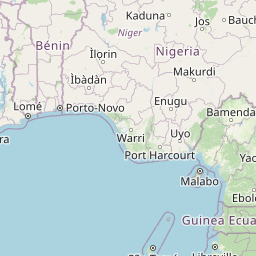
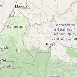
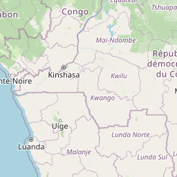
Equatorial Guinea Nationwide
Central Africa > Equatorial Guinea > Equatorial Guinea Nationwide
Français | Português | Español | Bahasa Indonesia | Melayu
Summary


- Central chimpanzees (Pan troglodytes troglodytes) & western lowland gorillas (Gorilla gorilla gorilla) are present in Equatorial Guinea.
- It has been estimated that 6,162 (CI: 3,976-11,150) individuals occur in the site.
- The great ape population trend is decreasing.
- The site has a total size of 28,050 km².
- Key threats to great apes are bushmeat hunting, logging, infrastructure development leading to habitat loss and increased access to forests.
- Conservation activities have focused on protection of priority areas.
Site characteristics
The Republic of Equatorial Guinea is located in west central Africa. The country comprises Bioko Island, Annobón Island, and the larger mainland region of Rio Muni, which lies between Cameroon and Gabon and includes the nearby islands of Corisco, Elobey Grande, Elobey Chico, and adjacent islets. Rio Muni covers an area of 26,017 sq. km. The vegetation consists mainly of Guineo-Congolian rainforest, with mangrove forests in the southwest estuary, riparian palm forests along the coast and inselbergs in the east (Murai et al. 2013). The highest altitude reaches 1,113 m in the Niefang Mountain range. Average annual temperature is around 27°C and annual mean rainfall is 2,500 mm (Murai et al. 2013).
Table 1. Basic site information for Equatorial Guinea Nationwide
| Species | Gorilla gorilla gorilla, Pan troglodytes troglodytes |
| Area | 28,050 km² |
| Coordinates | Lat: 1.556135 N , Lon: 10.460401E |
| Type of site | Unknown |
| Habitat types | Urban areas , Subtropical/tropical heavily degraded former forest, Agricultural land, Subtropical/tropical moist lowland forest, Subtropical/tropical moist montane forest, Wetlands (lakes, rivers, streams, bogs, marshes), Marine coastal/supratidal, Rocky areas (inland cliffs, mountain peaks) |
| Type of governance |
IUCN habitat categories Site designations
Ape status
The first gorilla survey, conducted in 1966, provided a nationwide density estimate of 0.58 to 0.86 gorilla per sq. km (Murai et al. 2013). Later on, in 1989, surve work led to an estimate of 0.22 to 0.45 nesting gorilla per sq. km, with the highest densities identified to be in Río Campo and the district of Nsork in the southeast of the country (Murai et al. 2013).
Table 2. Ape population estimates reported for Equatorial Guinea Nationwide
| Species | Year | Abundance estimate (95% CI) | Density estimate [ind./ km²] (95% CI) | Encounter rate (nests/km) | Area | Method | Source | Comments | A.P.E.S. database ID |
|---|---|---|---|---|---|---|---|---|---|
| Gorilla gorilla gorilla | 2005 | 2,325 (1,510–3,476) | Equatorial Guinea nationwide | Other | Strindberg et al. 2018 | ||||
| Gorilla gorilla gorilla | 2013 | 1,872 (1,082–3,165) | Equatorial Guinea nationwide | Other | Strindberg et al. 2018 | ||||
| Pan troglodytes troglodytes | 2005-2013 | 4,290 (2,894–7,985) | Equatorial Guinea nationwide | Other | Strindberg et al. 2018 | ||||
| Pan troglodytes troglodytes | 2011 | 7,824 (3,703–14,441) | Equatorial Guinea nationwide | Other | Murai et al. 2013 | survey effort of 233.94 km across 83 transects | |||
| Pan troglodytes troglodytes & Gorilla gorilla gorilla | 2011 | 11,097 (5,090–20,688) | Equatorial Guinea nationwide | Other | Murai et al. 2013 | survey effort of 233.94 km across 83 transects |
Threats
Fuelled by the country's oil boom, Equatorial Guinea's economy has rapidly developed. Forest concessions have grown significantly since the discovery of oil reserves in the early 1990s; in fact, between 1993 and 1997 concessions more than doubled to 1.5 million hectares (Murai et al 2013). The area further increased to 1.7 million hectares by 2001. This economic development has also led to greater urbanisation and increased infrastructure development and road construction throughout Río Muni (Murai et al. 2013).
Conservation activities
Two priority landscapes for great ape conservation have been identified, which cover parts of Rio Muni. First, the Monte Alén-Monts de Cristal-Abanga landscape, which incorporates the Monts de Cristal mountain chain running from northwest Equatorial Guinea to southeast Gabon. The Equatorial Guinea sector covers 5,570 sq. km (IUCN 2014). The second is the Río-Campo-Ma’an landscape, which comprises the Río Campo Natural Reserve (347 km²) in Equatorial Guinea and Campo Ma’an NP (CMNP, 2,640 km²) in Cameroon. The landscape falls in the Atlantic coastal forest zone, known for high floral diversity and several endemic plant species (IUCN 2014).
Challenges
Historically, the network of PAs has existed in Equatorial Guinea by law since 1988 (Ley 8/1988). Today, PAs in Río Muni cover 15.4% of the country’s land. However, since 2004 there are limited law enforcement activities undertaken to manage and protect these areas, when ECOFAC (Conservation et Utilisation Rationelle des Ecosystèmes Forestieres en Afrique Centrale) suspended its activities in Monte Alén National Park (Murai et al. 2013). This park is the only PA that has received any effective protection since the creation of the PA network in Rio Muni (Murai et al 2013). This lack of law enforcement is threatening wildlife populations (Murai et al. 2013).
Table 5. Challenges reported for Equatorial Guinea Nationwide
| Challenges | Specific challenges | Source | Year(s) |
|---|---|---|---|
| 4 Institutional support | 4.1 Lack of law enforcement | Murai et al. 2013 |
Enablers
Table 6. Enablers reported for Equatorial Guinea Nationwide
| Enablers | Specific enablers | Source | Year(s) |
|---|---|---|---|
| 1 Site management | |||
| 2 Resources and capacity | |||
| 3 Engaged community | |||
| 4 Institutional support | |||
| 5 Ecological context | |||
| 6 Safety and stability |
Research activities
Documented behaviours
Table 7. Behaviours documented for Equatorial Guinea Nationwide
| Behavior | Source |
|---|---|
| Not reported |
Exposure to climate change impacts
External links
Relevant datasets
References
IUCN (2014). Regional Action Plan for the Conservation of Western Lowland Gorillas and Central Chimpanzees 2015–2025. Gland, Switzerland: IUCN SSC Primate Specialist Group. 56 pp.
Murai, M., Ruffler, H., Berlemont, A., Campbell, G., Esono, F., Agbor, A., ... & Kühl, H. S. (2013). Priority areas for large mammal conservation in Equatorial Guinea. PloS one, 8(9), e75024.
Strindberg, S., Maisels, F., Williamson, E. A., Blake, S., Stokes, E. J., Aba’a, R., ... & Wilkie, D. S. (2018). Guns, germs, and trees determine density and distribution of gorillas and chimpanzees in Western Equatorial Africa. Science advances, 4(4), eaar2964.
Page created by: A.P.E.S. Wiki team Date: NA